10 most amazing Places in Israel

Israel is a country in the Middle East,on the southeastern shore of the Mediterranean Sea and the northern shore of the Red Sea. Israel offers a plethora of historical and religious sites,beach resorts,archaeological tourism,heritage tourism,and ecotourism.

List of Best Places in Israel;

1)The Western Wall,Wailing Wall,or Kotel is an ancient limestone wall in the Old City of Jerusalem. The Western Wall is considered holy due to its connection to the Temple Mount. The Wall was originally erected as part of the expansion of the Second Jewish Temple by Herod the Great. It is a large rectangular structure topped by a huge flat platform.

2)Sea of Galilee is a freshwater lake,situated in the north-east of Israel,between the Golan Heights and the Galilee Region. It is the lowest freshwater lake on Earth,and the second-lowest lake overall (after the Dead Sea,a saltwater lake). Historical and religious sites in the region draw both local and foreign tourists. The Sea of Galilee is one holy place in Israel were some miracle occured there.

3)Simeon bar Yochai was a 2nd century tannaitic sage in ancient Israel,he was one of the most imminent disciples of Rabbi Akiva. According to popular legends,he and his son,Eleazar B. Simeon,were noted Kabbalists. They were buried in the same tomb in Meron,Israel,which is visited by thousands every year to pay respect.

4)Masada is an ancient fortification in the southern district of Israel,situated on top of an isolated rock plateau,overlooking the Dead Sea. Build by Herod the Great between 37 and 31 B.C.E. Masada was declared a UNESCO World Heritage Site in 2001. This place is one of the best tourist attraction in Israel and most visited were you can experienced the panoramic view of the surrounding area.

5)Yad Vashem Established in 1953,it is located in the southern slope of Mount Herzl. The memorial consists of a 108-dunam (18 hectares;44.5 acres) complex Holocaust History Museum. As of 2011,more than 24,300 individuals have been recognized as Righteous Among the Nations. Yad Vashem houses the world's largest collection of artwork produce by the Jews and other victims of Nazi occupation in 1933-1945. The Memorial Museum is dedicated to the people of Jews and to those people who helped them against the Nazi Holocaust. Visit the memorial were you can experienced the life under Nazi captivity and pay respect to people who died there.

6)Church of the Nativity is a Basilica located in Bethlehem,West Bank. Originally commissioned in 327 by Constantine the Great and his mother Helena,the site is mark as the Birthplace of Jesus. The Church of the Nativity is the first church in the Palestine controlled area to be listed in the UNESCO World Heritage Site,and it is also listed as World Heritage in Danger,as it is suffering from damage due to water leaks. One of the holiest places in the Christian Community were you can feel the present of Jesus.

7)Ein Gedi is an oasis and a nature reserve located west of the Dead Sea,was declared as nature reserve in 1971,it has spring with flowing water year round,sanctuary of many Kings of plants,animals,and bird species. Kibbutz Ein Gedi,founded in 1956. The Kibbutz area contains internationally acclaimed Botanical Garden with an area of 10 ha (24.7 acres),and has more than 900 species of plants all over the world. Visit the area were you can see that desert can be a more wonderful place on Earth,it is one of the most visited place in Israel.

8)Shrine of Bahá'u'lláh is the most holy place for the Bahá'ís,located in Bahjí near Acre. The shrine contains the remains of their founder Bahá'u'lláh,along with his son Díyá'u'lláh who died in 1898. The shrine and it's surrounding gardens,as well as the Mansion of Bahjí was inscribed on the World Heritage List in July of 2008,along with the Shrine of the Báb in Haifa. It's not just a holy place for their followers it is also a place to see how nature's can provide beauty.

9)Shrine of the Báb located in Mount Carmel,Haifa,the structure is dedicated to the founder of Bábí Faith who's remain is in the shrine. The shrine is surrounded by 19 terraced gardens one of the recognizable in Haifa that stretches one kilometre from the base to the summit. In 2008,the shrine is listed as UNESCO World Heritage Site along with several other Bahá'í holy site in Haifa and the nearby city of Acre. This place is were you can see how beautiful a garden can be and admire how they were carefully planted.

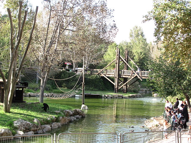
10) Jerusalem Biblical Zoo is located in Malha,Jerusalem. It is famous for its wildlife collections of animals,birds and reptiles that is mentioned in the Bible and it success in breeding endangered species. Opened in 1940 by a zoologist professor. Today,the zoo was renamed the Tisch Family Zoological Garden,If your an animal lovers and like to watch them play,and also want some knowledge about animals,visit the Jerusalem Biblical Zoo.

Photos courtesy of Wikimedia Commons
Likes and Comments at Facebook Page @ www.facebook.com/travelguideunlimited/

The Travel Guide: 10 most amazing places in Cyprus

The Travel Guide: 10 most amazing places in Cyprus

10 most amazing places in Cyprus

Cyprus is an island country in the Eastern Mediterranean and the third largest and the third most populous island in the Mediterranean. Archaeological remain includes the well-preserved Neolithic village of Khirokitia,and Cyprus is home to some of the oldest water wells in the world. Cyprus is a major tourist destination in the Mediterranean.
List of places in Cyprus;
1)Protaras is a predominantly tourist resort which comes under the administrative jurisdiction of Paralimni Municipality in Cyprus. Protaras has clear sky-blue waters and sandy beaches,and is one of the most popular diving destinations with some of the best dive sites in Cyprus and East Mediterranean.

2)Amathus was one of the most ancient royal city of Cyrus. Amathus was build on the coastal cliffs with a natural harbor and flourished at an early date. The prehistory of Amathus mixes myth and archaeological. Some archaeological findings in Amathus are pottery left by the Greeks of Euboea in the 10th century B.C.,palace and port during the post-Phoenician era of the 8th century B.C. and also a special burial grounds for infants,a tophet. Excavators also discovered the final stage of the Temple of Aphrodite which date approximately to the 1st century B.C.

3)Kourion was an ancient city on the southwestern coast of Cyprus. The Kourion archaeological area lies within the Akrotiri West Sovereign Base Area,and it is listed in the UNESCO World Heritage Site. Important excavations in Kourion Archaeological Area are;

  • The Theatre of Kourion was excavated between 1935 and 1950. Constructed in the northern slope of the defile descending to the Amathus Gate,the Theatre were reconstructed and repaired several times and was abandoned in the later-fourth century C.E. The enlarged cavea of the Roman phases could have accommodated an audience of as many as 3,500. The present remains of the theatre have been restored extensively.
  • The Baths and House of Eustulios situated along the crest of the southeastern cliffs immediately east and slightly above the theatre,the structure was excavated in 1933 and 1948. Constructed in the late 4th or early 5th centuries C.E. and remained occupied until the mid 7th century C.E.
  • The House of Achilles,located at the northwestern extent of the acropolis,at the southern end of a saddle connecting the acropoline Promontory to the hills to the north and west. It was constructed in the 4th century C.E.
  • House of  the Gladiators is located south and east of the House of Achilles. The structure date to the late 3rd century C.E.
  • Forum and the Baths the agora was constructed in the 3rd century A.D. over the remain of the public building of the 4th century to the early 1st century B.C.
  • Episcopal Precinct of Kourion constructed in the early 5th century A.D.,and successfully renovated in the 6th century A.D.,is among the most important Early Christian monuments yet excavated in Cyprus. The Precinct was destroyed during the Arab Raiding of the 7th century after which the settlement was reestablished in Episkopi.
  • The Northwest Basilica located northwest of the acropolis,a three-apse basilica was constructed in the late 5th century. A church was constructed within the church complex north of the main basilica. The basilica was destroyed in the Arab Raids in the mid 7th century.
  • The Coastal Basilica located below the west cliffs of the Acropolis,a three-apse and three-aisled basilica was constructed in the early 6th century.
  • The Sanctuary of Apollo Hylates,located 1.7 kilometres west of the Acropolis,was a Pan-Cypriot sanctuary,third in importance only to the Sanctuaries of Zeus Salaminos and Paphian Aphrodite. The Sanctuary at present was constructed in the 1st century and early 2nd century. The sannctuary was abandoned in the late 4th century.
  • The Stadium located 0.5 kilometres west of the acropolis was constructed during the Antonine period (138-180). The Stadium was 187 metre long,with a standing line marked put two stones circular posts,set wide enough to accommodate eight runners.
Kourion is a major Paragliding site in Cyprus and is flyable on most days in a year.

4)Bellapais Abbey or "The Abbey of Peace"is the ruin of a monastery build by Canons Regular in the 13th century on the northern side of the small village of Bellapais, in Turkish-controlled Northern Cyprus. The ruin is at an altitude of 220 metres above sea level,and commands a long view down to Kyrenia and the Mediterranean Sea. The site is also a museum,host a venue for concerts and lectures,and also for local music festival.

5)Platres is a mountainous village in Cyprus,the locals called it Pano Platres (Upper Platres),located in the southern slopes Troödos Mountains and is one of the Krasochoria. Platres is the largest Troödos resort,situated about 5 kilometres from Troödos square and 45 kilometres (28 mi) south-east of the capital city of Nicosia. Platres is a very old village that existed during the Lusignan Era (1192-1489 A.D.) and the Venetian Era (1489-1571 A.D.).

6)Ayia Napa is a resort at the far eastern end of the southern coast of Cyprus. Ayia Napa Monastery is the only building with historical interest in the Ayia Napa area. The Makronissos Tombs are an archaeological site consisting set of  ancient rock-cut tombs. Other building found in Ayia Napa are two municipal museums:the Tornaritis-Pierides Museum of Marine Life,and the Thalassa Ayia Napa Municipal Museum,that displays marine fossils,speciment,and Dioramas. The Ayia Napa Sculpture Park,which is located in the east side of Ayia Napa,was recently completed. In 2013,the City of Ayia Napa was recently completed has inaugurated the Ayia Napa Fame Square,Singers,DJs,Artists,and Politicians are inducted to this square. The WaterWorld Themed WaterPark is an ancient Greek themed waterpark that is one of the biggest themed water parks in Europe,with more than 25 rides and attractions. Opened its doors in 1996.

7)Kato Pafos Archaeological Park is located in Paphos,southwest of Cyprus and is situated in Paphos Harbour. The park is under excavation,is within the Nea Paphos (New Paphos) section of the coastal city. Some of the most significant remains are four Roman villas,the house of Dionysos,the house of Orpheus,the house of Aion and the house of  Theseus,all with preserved mosaic floor. Other excavations have uncovered an Agora,Asklipieion,'Limeniotessa' Basilica in ruins,the Odeion,'Saranta Kolones'Fortress,the Hellenistic-Roman Theatre,and a necropolis known as the 'Tombs of the King's.

8) Larnaca Castle is a castle located in the southern coast of Cyprus. It was constructed to defend the the southern coast of Cyprus and the harbor town of Larnaca and was later used as an artillery station,prison,and a museum. Today,the castle is used as a museum,while the courtyard used as an open-air theatre that can accommodate 200 people.

9)Church of Saint Lazarus is a late-9th century church in Larnaca. It belongs to the Church of Cyprus. The church is an elongated building measuring 32.5 m x 14.5 m with a tripartite sanctuary. The tomb of Lazarus of Bethany is located in the church.

10)Famagusta Gate is a gate  in the Nicosia walls,the capital city of Cyprus. It is the chief gate of the city: the Porta of Guiliana,or "di sotto" of Fra Stefano Lusignano's Chorograffia,known as Famagusta Gate in modern times. The gate was build by the Venetians in 1567,and was restored by the Ottomans in 1812. In 1980,the Nicosia Municipality restored the gate and re-use it as a cultural centre. Restoration was completed in 1981,and since then the Famagusta Gate has become a busy venue for exhibitions.

Text and Photos courtesy of Wikipedia and Wikipedia Commons.

10 Magnificent places to visit in Jordan

Jordan is an Arab kingdom in Western Asia,it is strategically located at the crossroads of Asia,Africa and Europe. Jordan an Arab nation on the West Bank of the Jordan River,is defined by ancient Monuments,nature reserves and seaside resorts. The tourism sector is considered a cornerstone of the economy,in 2010,there were 8 million visitors in Jordan. Majority of tourists coming to Jordan are from Europeans and Arab countries. It is home to 100,000 archaeological and tourist sites,modern entertainment and recreation in urban areas,mostly in Amman,also attract tourist.

List of Places in Jordan;
1) Al-Maghtas meaning "baptism"or"emersion"in Arabic,is an archaeological World Heritage in Jordan on the east bank of Jordan River,officially known as Baptist site"Brittany Beyond Jordan"(Al-Maghtas).it is co soldered to be the original location of  the Baptism of Jesus and the ministry of John the Baptistand has been venerated as such since at least the Byzantine Period. Al-Maghtas includes two principal archaeological areas. The remnants of a monastery on a mound known as Jabal Mar-Elias (Elijah's Hill) and an area close to the river with remains of churches,ponds and pilgrim and hermit dwellings. The site has then seen several archaeological digs,four Papal visits and state visits and attract tourists and pilgrimage activity.
2) Wadi Rum also known as The Valley of the Moon is a valley cut into the sandstone and granite rock in southern Jordan,60 km (37 mi) to the east of Aqaba;it is the largest Wadi in Jordan. The name Rum mostly likely comes from  an Aramaic root meaning 'high' or 'elevated'. Wadi Rum is home to the Zalabia Bedouin who,working with climbers and trekkers who,have made a success of developing eco-adventure tourism,now their main source of income. Popular activities in the desert environment includes camping u set the Sun,riding Arab horses,hiking and rock-climbing among the massive rock formations.

3) Dead Sea is a salt lake bordered by Jordan to the east and Israel and Palestine to the west. It's surface and shores are 429 metres (1,407 ft) below sea level,Earth's lowest elevation on land. The Dead Sea is 304 metres (997 ft) deep,the deepest hypersaline lake in the world. It is 9.6 times as salty as the Ocean,and one of the world's saltiest body of water. The Dead Sea has attracted visitors from around the Mediterranean basin for thousands of years. It was one of the world's first heath resort (for Herod the Great),and it has been the supplier of a wide variety of products. The Dead Sea area has become a location for health research and potential treatment for several reasons,the region's climate and low elevation have made it a popular center for assessment of putative therapies.

  • Psoriasis: climatotheraphy in the Dead Sea may be a therapy for Psoriasis by sunbathing for a long periods in the area due to its positions below sea level and subsequent result that UV rays are partially blocked by increased cloud cover over the Dead Sea.
  • Rhinosinusitis patients receiving Dead Sea saline nasal irrigation exhibited improved symtom relief compared to standard hypertonic saline spray in one study.
  • Osteoarthritis,Dead Sea mud pack therapy has been suggested to temporarily relieved pain in patients with osteoarthritis of the knees. According to researchers of the Ben Gurion University of the Negrev,treatment with mineral-rich mud compresses can be used to augment conventional medical therapy.
4) Petra originally known to the Nabataeans as Raqmu,is a historical and archaeological city in the southern Jordan. The city is famous for its rock-cut architecture and water conduit system. Another name for Petra is the Rose City due to the color of the Stone out of which it is carved. Established possibly as early as 312 B.C. as the capital city of the Arab Nabataeans,it is a symbol of Jordan,as well as Jordan's most-visited tourist attraction. The site remained unknown to the western world until 1812,when it was introduced by a Swiss explorer. It was described as "a red-rose city half as old as time". UNESCO describe it as "one of the most precious cultural properties of man's cultural heritage". Petra was named amongst the New7Wonders of the World in 2007,and has been a UNESCO World Heritage Site since 1985.

5) Ajloun Castle is a 12th century Muslim castle situated in northwestern Jordan. It is placed on a hilltop belonging to the Jabal Ajlun (Mount Ajlun) district,also known as Jabal 'Auf after a Bedouin tribe which had captured the area in the 12th century. From its high ground the castle was guarding three wadis which descend towards the Jordan Valley. It was build by the Ayyubids in the 12th century and enlarged by the Mamluks in the 13th century. The castle stands on the ruins of a monastery,traces of which were discovered during archaeological excavations. Ajlun Castle is open for tourism. Many areas of the castle can be explored. Inside there is also a museum exhibitions with many interesting artifacts from the various time periods of the region.

6) Dana Biosphere Reserve is Jordan's largest nature reserve,located in south-central Jordan. Dana Biosphere Reserve was founded in 1989 in the area around the Dana Village and Wadi Dana comprising 308 square kilometres (119 sq mi). The people of Ata'ta (or Al Atata) tribe are the native inhabitants. Besides the present of Ata'ta people,archaeological discoveries suggest Palaeolithic,Egyptian,Nabataean,and Roman settlement in Dana. The diverse environment of Dana is home to 703 plant species,215 species of birds,and 38 species of mammals. Of the hundreds of plants species inhabiting Dana,three can be found nowhere else in the world. Many plants,especially trees and shrubs,grow in the highlands of the nature reserve.

7) Mount Nebo is an elevated ridge in Jordan,approximately 817 metres (2,680 feet) above sea level. The view from the summit provides a panoramic of the holy Land. On the highest point in the mountain,Syagha,the remains of a Byzantine church and monastery were discovered in 1933. The church was first constructed in the second half of the 4th century to commemorate the place of Moses death. It was enlarged in the late 5th century A.D.,and rebuild in A.D. 597.

8) Umm ar-Rasas is located 30 kilometres Southeast of Madaba in central Jordan. The site has been allied to the biblical settlement of  Mephaat mentioned in the Book of Jeremiah. In 2004,the site was inscribed as a UNESCO World Heritage Site,and is valued by archaeologists for its extensive ruins dating to the Romans,Byzantine,and early Muslim period. The most important discovery on the site was the mosaic floor of the Church of St. Stephen. It was made in 786 (discovered in 1986). The perfectly preserved mosaic floor is the largest one in Jordan. It overlays another,dameged,mosaic floor of the earlier (587) Church Bishop Sergius. Another four churches were excavated nearby with traces of mosaic decorations.

9) Machaerus is a fortified hilltop palace in Jordan,25 kilometres (16 mi) southeast of the mouth of the River Jordan on the eastern side of the Dead Sea. The village on the plateau to the east of the mountain is known as Muqāmir. The site was visited in 1807 by the Frisian explorer,archaeological excavation of Machaerus was begun in 1968,and in 1973 a German scholar,identified and studied the wall by which the Romans encircled the defenders within the fortress. In 1978-1981,excavations were carried out,from the Franciscan Biblical Institute in Jerusalem. The ruins remain in remarkably untouched conditions to this day. Machaerus is the locations of the the imprisonment and execution of John the Baptist,according to the chronology of the Bible,this infamous execution took place in 32 A.D. shortly before the Passover,following an imprisonment of two years.

10) Umm el-Jimal is a village in northern Jordan approximately 17 kilometres east of Mafraq. It is primarily notable  for the substantial ruins of a Byzantine and early Islamic town which are clearly visible above the ground,as well as an older Roman,located in the southwest of the Byzantine ruins. Umm el-Jimal was rediscovered in the nineteenth century,during the time of Western interest in antiquities. In 2014,extensive damage was done to the site by tomb raiders. Sparked by rumors of gold,looters have destroyed many tombs,they are also looking for ceramics,glasswares,lamps, masonry and bits of jewelry.

Photos and text courtesy of Wikipedia and Wiki Commons.
Visit Facebook Page @ www.Facebook.com/travelguideunlimited/

10 incredible places to visit in Bahrain

Bahrain,is an island country situated near the western shores of the Persian Gulf in the Middle East. It is a small archipelago centered on Bahrain Island,its largest land mass. It is 780 km² in size,makimg it the third smallest nation in Asia after the Singapore and Maldives. As a tourist destination,Bahrain recieved over eight million visitors in 2008 though the exact numbers varies yearly. Most of this are from surrounding Arab states although an increasing number hail from outside the region due to growing awareness  of the Kingdom's Heritage and it's higher profile.

List of places in Bahrain;

1) Qal'at al-Bahrain,is an archaeological site located in Bahrain,on the Arabian Peninsula,also known as the Bahrain Fort or Fort of Bahrain and previously as the Portugal Fort. Archaeological excavations carried out since 1954 have unearthed antiquities from an artificial mound of 12 metres (39 ft) height containing stratified layers,created by various occupants by 2300 B.C. up to the 18th century,including Kassites,Portugese,and Persians. It was once the capital of the Dilmun civilization and was inscribed as UNESCO World Heritage Site in 2005.
The area is though to have been occupied for about 5,000 years and contains a valuable insight into the Copper and Bronze Ages in Bahrain. The first Bahrain Fort was build around three thousand years ago,on the north-eastern peak of Bahrain island. The present fort dates from the six century A.D. Qal'at al-Bahrain is a typical tell -an artificial mound created by many successive layers of human occupation. About 25% of the has been excavated revealing structures of different types: residential,public,commercial,religious and military. The site contains many areas and walls,including Saar necropolis,Al-Hajjar necropolis,Kassite palace,Madimat Hermand necropolis,Madimat Isa necropolis,Al-Maqsha necropolis,Palace of Uperi,Shakhura necropolis,and the Northern city wall. The ruins of the Copper Age consists of two sections of the fortification wall surrounding streets and houses,and a colossal building on the edge of the moat Portuguese fort in the center. Barbar pottery has been unearthed around the walls of the central building,dating back to the same age as the Barbar Temples,although some of the other pottery and range of unearthed artifacts indicated that they predated the temples,dating back to 3,000 B.C. or later. Many vessels have been unearthed on the site,and Danish excavations in the Palace of Uperi area revealed "snake bowls",sarcophagi,seals and a mirror,amomg other things. 
The fortifications in the excavations tel were found around the area township and were erected in cardinal directions. The fort walls are seen now only in the northern,western and southern slopes of the tel,and the eastern side is yet to be excavated. The place prospered 'til 1800 B.C. when it was deserted. Eventually the town became covered with drift sand from the sea. Metal artifacts found in the tel where limited to copper pieces,fishing tools and a socketed spearhead. And other important findings in the sites.

2) Bahrain National Museum,is the largest and one of the public museum in Bahrain. It is constructed near the King Faisal Highway in Manama and opened in December 1988. The museum complex is cover 27,800 sq metres and consists of two buildings. The museum possessed a rich collections of Bahrain's ancient archaeological artifacts acquired since 1988,and covers nearly 5,000 years of Bahrain's history. The complex includes three halls devoted to archaeology and the ancient civilisation of the Dilmun,while two other halls depict the culture and lifestyle of Bahrain's recent pre-industrial past. In 1993 a further hall has opened, the Natural History Hall,focuing on the natural environment of Bahrain. This hall features specimens of Bahrain's fauna and flora. Among the exhibits in the ancient history section is an actual burial mounds and another features is a tableau which depicts a scene from the Epic of Gilgamesh. Old Quranic Manuscripts,notes on astronomy and historical documents and letters are exhibited in the Documents and Manuscripts Hall.

3) Khamis Mosque is believed to be the first mosque in Bahrain,build during the era of the Umayyad caliph Umar II. It is considered to be one of the oldest mosque in the region,as its foundation is believed to have been laid as early as 692 A.D. An inscription found on the site,however,suggests a foundation date of something during the 11th century. It has since been rebuild twice in both the 14th and 15th centuries,when the minarets were constructed. The Khamis Mosque has been partially restored recently. The present main buildings has two phases

  • An early prayer hall with a flat roof supported by wooden columns dated to the 14th century.
  • A later section of the flat roof was added,supported on arches resting on thick masonry piers (which have been dated to 1339). Islam was propagated to Bahrain in the 7th century A.D. when Muhammad sent an envoy al-Ala'a al-Hadrami,preaching Islam to the Governor of Qatar and Bahrain at that time,Munzin ibn Sawa al Tamimi. Mishrab slab was a limestone slab,in the form of a mishrab. The slab was discovered during the restoration works on the mosque and is believed to have originated from the 12th century A.D. Inscriptions of two verses from the Qur'an are present on the slab.
  • 4) Arad Fort is a 15th century fort in Arad,Bahrain. Formerly guarding a separate island of its own,the fort and it's surroundings have since been joined to Muharraq Island. Arad Fort was build in the typical style of  Islamic fort during the 15th century before the Portuguese invasion of Bahrain in 1622 A.D. The fort is one of the compact defensive forts in Bahrain. The fort is square and on every corner there is a cylindrical tower. It is surrounded by a small trench which is used to be filled with water from wells that were drilled especially for this purpose. In every corner of the upper wall of the fort there are nose shaped.openings for marksmen. Arad Fort was most recently restored between 1984 and 1987,in order to maintain the historical authenticity and value of Arad Fort,exclusively traditional materials were used,such as coral,stone,lime and tree trunks.
5) Barbar Temple is an archaeological site located in the village of Barbar,and considered to be part of Dilmun culture. The most recent of the three Barbar Temples was rediscovered by a Danish archaeological team in 1954. A further two temples were discovered on the site with the oldest dating back to 3,000 B.C. The temples were build of limestone blocks,believed to have been carved out from Jidda island. The three temples were build atop one another with the second build approximately 500 years later and the third added between 2100 B.C. and 2000 B.C. The temple contains two altars and a natural water spring. During the excavations of the site many tools,weapons,pottery and small pieces of gold were found which are now on display in the Bahrain National Museum. The most famous find was a bronze bull's head.

6) Dilmun Burial Mounds are a number of necropolis areas on the main island of Bahrain dating back to the Dilmun,the Umm an-Nar culture and later eras. Known since ancient times as an island with a very large number of burials,the (originally) quite a number of square kilometres of mounds were said to be one of the largest cemeteries in the ancient world. Recent studies have shown that the estimated/approximately 350,000 ancient grave mounds could have been solely produced by the local population over a number of thousands of years.
Attempt to protect the burial mounds have run into opposition by religious fundamentalist who considered them unIslamic and have called for them to be concreted over for housing.

7) Tree of Life,Bahrain is an approximately 400-year-old,9. 75 metres (32 ft) high Prosopis cineraria tree located 2 kilometres (1.2 miles) from Jebel Dukhan. The tree stands on top of a 7.6 metres (25 feet) high sandy tel that form around a 500-years-old fortress. The tree is a local tourist attraction,as it is the only major tree growing in the area. The tree is visited by approximately 50,000 tourists every year. Since October 2010,archaeologists have unearthed pottery and othe artifacts in the vicinity of the tree. Some of which may date back to the Dilmun civilisation.

8) Al Areen Wildlife Park is a nature reserve and zoo,located in Sakhir,Bahrain. It is one of the five other protected areas in the country and it is the only designated protected area on land,in the country. The park covers a total area of 7 km sq and was first establish in 1976. Species native to Bahrain,both plants and animals,as well as species from Africa,South Asia are present in the zoological park. In 2013,the park attracted 199,235 visitors to the park. The park features 100,000 planted flora and trees,and more than 45 species of animals,82 species of birds and 25 species of flora.

9) Beit Al Quran is a multi-purpose complex dedicated to the Islamic arts and is located in Hoora. Established in 1990,the complex is most famous for its Islamic museum,which has been acknowledged as being one of the most renowned Islamic museums in the world. Construction of the building began in 1984 and the museum opened in March 1990. It was build to "accommodate a comprehensive and valuable collections of the Qur'an and other rare Manuscripts",a concepts which,according to a regional magazine,is unique in the Persian Gulf region.

10) Al Father Grand Mosque is one of the largest mosque in the world,encompassing 6,500 square metres and having the capacity to accommodate over 7,000 worshiper at a time. The mosque was build in 1987 and was named after Ahmed Al Fateh,the founder of Bahrain. The huge dome build on top of Al Fateh Mosque is constructed entirely of fiberglass,the dome is currently the world's largest fiberglass dome. The library of Al Fateh Islamic center has around 7,000 books,some as old as 100 years or more.
Photos and text courtesy of Wikipedia and Wiki Commons.

10 outstanding places in Saudi Arabia

Saudi Arabia is a desert country encompassing most of Arabian Peninsula,with Persian and Red Sea (Arabian) Gulf coastlines. Known as birthplace of Islam. Officially known as Kingdom of Saudi Arabia,is geographically the fifth largest state in Asia and second-largest state in the Arab world. Although most tourists in Saudi Arabia still largely involves religious pilgrimage,there is growth in the leisure tourism sector. According to the World Bank,approximately 14.3 million people visited Saudi Arabia in 2013,making it the world's 19th most visited country. In December 2013,Saudi Arabia announced his intention to begin issuing tourist visas for the first time in its history.

List of places in Saudi Arabia;
  1. Masjid al-Haram also called the Sacred Mosque,and the Grand Mosque or Great Mosque of Mecca,i s the largest mosque in the world and surround Islam's holiest place,Kaaba in the city of Mecca. Muslims face Qibla (direction of Kaaba) while performing the Salat (obligatory daily prayers). One of the Five Pillars of Islam requires every Muslims to perform the Hajj pilgrimage,one of the largest annual gatherings of people in the world,at least once on his or her lifetime if able to do so,including TawafTawaf (circumambulation) of the Kaaba. The current structure covers an area of 356,800 square metres (88.2 acres) including the outdoor and indoor praying spaces and is open at all times. The ,the direction that Muslims turn to in their prayers (salary)-is toward the Kaaba and symbolizes unity in worshiping one Allah (God). At one point the direction of the Qibla was toward Battery Al-Maqdis (Jerusalem) (and is therefore called the first of the two Qiblas);however,this only lasted in seventeen months,after which the Qibla become oriented towards the Kaaba in Mecca. According to accounts from Muhammad's companions,the change happened very suddenly during the noon prayer in Medina in the Masjid Al-Qiblatain. Pilgrimage,the Haram is the focal point of the Hajj and Umrah pilgrimages that occurs in the month of Dhu Al-Hijjah in the Islamic calendar and at anytime of the year,respectively. The Hajj pilgrimage is one of the Pillars of Islam,required of all abled-bodied Muslims who can afford the trip. In recent times, over five million Muslims perform the Hajj every year. Some of the rituals performed by the pilgrims are symbolic of historical incidents. For examples,the episodes of Hagar's search of water is emulated by Muslims as they run between the two hills of Al-Safa and Al-Marwah. The Hajj is associated with the life of Islamic prophet Muhammad from the 7th century,but the ritual of pilgrimage to Mecca is considered by Muslims to stretch back thousands of years to the time of Ibrahim (Abraham). The Kaaba is a cuboid-shaped building in the center of Masjid al-Haram and is one of the most sacred site in Islam. All Muslims around the world face the Kaaba during prayers,no matter where they are. The direction from the location of the person who prays to the Kaaba is called the Qibla. The Hajj requires pilgrims to walk seven times around the Kaaba in a counter-clockwise direction. This circumambulation,the Tawaaf,is also performed by pilgrims during the Umrah (lesser pilgrimage). The Black Stone is the eastern cornerstone of the Kaaba. It was set intact into the Kaaba's wall by Muhammad in the year 605,five years before his first revelation. Since then it has been broken into a number of fragments and is now cemented into a silver frame in the side of the Kaaba. It's physical appearance is that of a fragmented dark Rock,polished smooth by the hands of millions of pilgrims. Many of the pilgrims,if possible,stop and kiss the Black Stone,emulating the kiss that Islamic tradition record it having having received from Muhhamad. If they cannot reach it,they point to it on each of their seven circuits around the Kaaba. The Maqām Ibrahim (Abraham's place of standing) is a rock that reportedly has an imprint of Abraham's foot,which is kept in a crystal dome next to the Kaaba. This rock was identify by most Islamic scholars as one behind which  Muhammad prayed when he circumambulated the Kaaba. Several traditions existed to explained how Abraham's footprint miraculously appeared in the stone,including one suggesting it appeared when Abraham stood on the stone while building the Kaaba:when the walls become to high,Abraham stood in the maqām,which miraculously rose up to let him continue building and also miraculously went down in order to allow Ishmael to hand him stones. Other traditions held that the footprint appeared when the wife of Ishmael washed Abraham's head,or alternatively when Abraham stood atop it in order to summon the people to perform the pilgrimage to Mecca. Al-Safa and Al-Marwah are two hills,now located in the Masjid al-Haram. In Islamic tradition, Abraham's wife Hagar ran between the hills of Al-Safa and Al-Marwah looking for water for her infant son Ishmael until God eventually revealed her the ZamZam. Muslims also travel back and forth seven times during the ritual pilgrimage of Hajj and Umrah as a remembrance to her sacrifice. Al-Safa,from which the ritual walking begins,is located approximately half a mile from the Kaaba. Al-Marwah is located about a 100 m (330 ft) from the Kaaba. The distance between Al-Safa and Al-Marwah is approximately 450 m (1,480 ft). The Zamzam well,is a well located 20m (66 ft) east of the Kaaba. According to Islamic belief,it begin circa 2150 B.C.E. when Abraham's infant son Ishmael was thirsty and kept crying for water.
  2. Al-Masjid an-Nabawi is a mosque established and originally build by the Islamic prophet Muhammad,situated in the city of Medina. Al-Masjid an-Nabawi was the second mosque build in the history of Islam and is now one of the largest mosque in the world. It is the second-holiest site in Islam,after Masjid al-Haram of Mecca,it is always open,regardless of time and date. The site was originally adjacent to Muhammad's house;he settled there after his Hijra (emigration) to Medina in 622 CE. He shared in the heavy work of construction. The original mosque was an open-air building. The mosque serves as community center,a court,and a religious school. In 1909,it become the first place in Arabian Peninsula to be provided with electrical light. Many pilgrims who performed the Hajj go on to Medina to visit the mosque due to its connections to the life of Muhammad. After the expansion during the reign of the Umayyad caliph al-Walid I,it now incorporates the final resting place of Muhammad and the first two Rashidun caliphs Abu Bakr and Umar. One of the most notable features of the site is the Green Dome in the south-east corner of the mosque,originally the Aisha's house,where the tomb of Muhammad is located. In 1279,a wooden cupola was build over the tomb which was later rebuild and renovated multiple times in late 15th century and once in 1817. The current dome was added in 1818 by the Ottoman Sultan Mahmud II,and it was first painted green in 1837,hence becoming known as the Green Dome. The two tiered mosque has a rectangular plan. The Ottoman prayer hall faces towards the south. It has a flat paved roof topped with 27 sliding domes on square bases. Holes pierced into the base of each dome illuminate the interior. The roof is also used for prayers during peak times,when the domes slide out on metal tracks to shade the areas of the roof,creating light wells for the prayer hall. The heart of the mosque houses a very special but small area named Riad ul-Jannah (Gardens of Paradise). It extends from Muhammad's tomb (Rawdah) to his pulpit (minbar). Pilgrims attempt to visit the confines of the area,for their is a tradition that supplications and prayers uttered here are never rejected. Riad ul-Jannah is considered to be a part Jannah (Paradise). It was narrated from Abu Hurayrah that Muhammad said."The area between my house and my minbar is one of the gardens of Paradise,and my minbar is on my cistern (Hawd)". As per Muhammad,Rawdah is also in heaven,the same Rawdah which is currently in the mosque. It is floored with green carpet just to identify it.and the entire mosque is floored with red carpet. It holds the tomb of Muhammad and two of its companions and first caliphs Abu Bakr and Umar in al-Khattab. A fourth grave is reserved for Jesus,as it is believed that he will return and will buried at the site. The site was covered by Green Dome. It was constructed in 1817 C.E. during the reign of Ottoman Sultan Mahmud II and painted green in 1837 C.E. There are two Mihrabs in the mosque,one was build by Muhammad and others was build by the third Rashidun caliph Uthman. The one build by the latter was larger than than of Muhammad's and act as the functional mihrab,whereas Muhammad's mihrab is a "commemorative"mihrab. Beside the mihrab,the mosque also has other niches which act as indicators for praying. This include mihrab al-tahajjud which was build by Muhammad for the tahajjud,mihrab Fatima. The original Minbar used by Muhammad was a "wood block of date tree". This was replaced by him with a tamarisk one,which had a dimensions of 50 centimeters (0.50 m) x 125 metres (410 ft). Also in 629,a three staired ladder was added to it. The first caliphs Abu Bakr and Umar,did not used the third step "due to respect for the prophet",but the third caliph Uthman placed the fabric dome over it and the rest of the stairs were covered with ebony. The minbar was replaced by Baybars I in 1395 and later by Shaykh al Mahmudi in 1417. This was also replaced by a marble one by Qaitbay in the late fifteenth century,which as of August 2013,is still used in the mosque. The first Minarets (four in numbers) of 26 feet (7.9 metres) high were constructed by Umar. In 1307,a minaret titled Bab al-Salam was added by Muhammad ibn Kalavun which was renovated by Mehmed IV. After the renovation project of 1994,there were ten minarets which were 104 metres high. The minarets upper,buttom and middle portion are cylindrical,octagonal,and square shaped respectively.
  3. Dariyah formerly romanized as Dereyeh and  Dariyya is a town in Saudi Arabia located on the north-western outskirt of the Saudi capital,Riyadh. Diriyah was the original home of the  Saudi Royal Family,and served as the capital of the Emirate of Diriyah under the first Saudi Dynasty from 1744 to 1818. Ruins of the old city of Diriyah lay on either side of the narrow valley known as Wadi Hanifa,which continue southwards through Riyadh and beyond. Consisting almost entirely of mud-brick structures,the ruins are divided into three districts,Ghussaibah,Al-Mulaybeed,and Turaif,set on top of hills,overlooking the valley. Of the three,Turaif is the highest,and it's bottom is easily accessible to tourists by foot. Part of the city wall,running along the edges of the wadi and also made of mud-bricks,are still extant along with some short of observation towers. The modern city is build at a lower altitude at the foot of the hill upon which Turaif is located. To the north of the town,inside the valley,are numbers of gardens,palm,gloves and small farms and estates. A dam known as Al-llb lies farther north. The old city's historical structures include;Salsa Palace,it has the residence and first home of the Al Said Amirs and Imams during the First Saudi State. It is considered the largest palace on the site,rising four stories high. It is composed of five main parts build at different consecutive periods of time. It was probably finished by Saud ibn Abdul Aziz ibn Muhammad ibn Saud,who was Imam from 1803 to1814. Saad bin Saud Palace,one of the largest palace on the site,it is famous for its courtyard,which was used as a stable. The Palace is completely restored and several stories high.The Guest House and At-Turaif Bath House a traditional building consisting of a number of small courtyards surrounded by rooms. The Bath House is famous for its different architectural styles and shows how the building was waterproofed by using different plasters. Both the Guest and Bath Houses were supplied with water from a well in the wadi. Iman Mohammad bin Saud Mosque,a mosque build during the reign of Imam Mohammad bin Saud. Sheikh Mohammed bin Abdulwahab used to give lessons about his reformed movement of Islam in this mosque. It become a center for religious education. Students used to travel to it from all parts of the Arabian Peninsula. Mosim Park: a football ground in the Nakheel area. Mosim Park was erected in 2007 after Mosim FC,a football team in Dir'iyah moved there from their old ground downtown of Riyadh.
  4. Mada'in Saleh also called Al-Hijr or Hegra,is an archaeological site located in the Sector of Al-Ula sector,within the Province of Al-Madinah in the Region of the Hejaz,Saudi Arabia. A majority of the vestiges date from the Nabatean Kingdom (1st century A.D.). The site constitutes the kingdom's southernmost and largest settlements after Petra,its capital. Traces of Lihyanite and Roman occupation before and after the Nabatean rule,respectively,can also be found. In 2008 UNESCO proclaimed Mada'in Saleh as a site of patrimony,becoming Saudi Arabian 's first World Heritage Site. It was chosen for it well-preserved remains from late antiquity, especially the 131 rock-cut monumental tombs,with their elaborately ornamented facades,of the Nabatean kingdom. The archaeological site in Mada'in Saleh is situated 20 kilometres (12.4 mi) north of the town of Al-`Ula,400 km (248.5 mi) north-east of Medina,and 500 km (310.7 mi) south-east of Petra,Jordan. The site is on a plain,at a foot of a basalt plateau,which forms a portion of the Hijaz Mountains. The western and north-western portions of the site contains a water table that can be reached at a depth 20 m (65.6 ft). The settings is notable for its desert landscape,marked by sandstone outcrops of various sizes and heights. Although the Al-Hijr site was proclaimed as an archaeological treasure in the early 1970s,few investigator had been conducted since. The prohibition on the veneration of objects/artifacts has only resulted in minimal low-key archaeological activities. This conservative measures have started to ease up beginning in 2000,when Saudi Arabia invited expeditions to carry out archaeological explorations,as part of the government's push to promote cultural Heritage protection and tourism. The archaeological site was proclaimed as a UNESCO World Heritage Site in 2008. The Nabatean site of Hegra was build around a residential zone and it's oasis during the 1st century A.D. The sandstone outcrops were carved out to build the necropolis. There are four necropolis areas have survived,which featured 131 monumental rock-cut tombs spread out over 13.4 km (8.3 mi),many with inscribed Nabatean epigraphs on their facades. Non-monumental burial sites,totaling 2,000,are also part of the place. A closer observation of the facade indicates the social status of the of the buried person-the size and ornamentation of the structure reflect the wealth of the person. Some of the facades had plates on top of the entrances providing information about the grave owners,the religious system,and masons who carved them. Many graves indicate military ranks,leading archaeologists to speculate that the site might have once been a Nabatean military base,meant to protect the settlement's trading activities. A religious area,known as Jabal Ithlib,is located to the north-east of the site. It is believed to have been originally dedicated to the Nabatean deity Dushara. A narrow corridor,40 metres (131 ft) long between the high rocks and reminiscent of the Siq in Petra. The residential area is located on the middle of the plain,far from the outcrops. The location of the site at the crossroads of trade,as well as the various languages,scripts and artistic styles reflected in the facades of its monumental tombs further set it apart from the archaeological sites. It has duly earned the nickname "The Capital of Monuments" among Saudi Arabia's 4,000 archaeological sites.
  5. Dumat al-Jundal is an ancient city of ruins located in north-western of Saudi Arabia in the Al Hawd Province,it is located 37 km away from Sakakah. The name Dumat Al Jandal means literally "Dumah of the Stone",since this was the territory of Dumah,one of the twelve son's of Ishmael. The city's ancient Akkadian name was Adummatu. The city has a history dating back to the 10th century B.C. and it is mentioned in Akkadian inscriptions of the Assyrian Empire dating to 845 B.C. in which it is referred to as Adummatu and is described as the capital of an Arab kingdom,sometimes named as Qedar (Qidri). The names of five powerful Arab queens that ruled this city are known,among them Zabibe,Samsi,Tabua and Te`elhunu. The latter is also given the title of high priestess of Atarsamain,a deity of fertility,love and war associated with Ishtar. Dumat al-Jundal was the site of an important temple dedicated to the Ishtar. The mosque of Omar ibn al-Khattab is situated in the town of Dumat al-Jandal,a major intersection of ancient trade routes linking Mesopotamia,Syria and the Arabian Peninsula. The mosque itself was build in 634-644. The north (qibla) wall of the mosque faces the al-Marid castle across the street. On its other three sides,it is surrounded by dense urban fabric. Like other buildings in the town,the mosque is build in stone. Al Dar`i Qiarter is located in the neighborhood of Omar Bin Al Khatab Mosque and Marid Fortress,which represent the old quarter of Dumat al-Jandal. Al Dar'i Quateris considered to be one of remaining antiquities of Dumat al-Jandal's ancient city which has escape the demolition shovels befalling the historical market of Dumat al-Jandal 25 years ago.
  6. Bir Hima is a rock art site in Najran Province,in south-east of Saudi Arabia,about 200 km (120 mi) north of the city of Najran. An ancient Palaeolithic and Neolithic site,the Bir Hima Complex covers the time period of 2500-1000 B.C. Bir Hima contains numerous troughs whose type is similar from North Arabia to Yemen. Saudi Arabia's rock art,which has found appreciation in recent years,is considered among the richest in the world along with other examples found in Australia,India and South Africa. Bir Hima,as part of Najran,is a treasure trove of petroglyphs,eclipsed only by those found in the Jubba region. Here,100 sites have been identified. In the Najran area,as many as 6,400 human and animal illustration,which includes more than 1,800 camels and 1,300 humans depictions,have been recorded. At this important rock art site,apart from depictions of humans,giraffes,and other animals,the sixth century inscriptions of Dhu Nuwas,a Himyarite King who occupied Najran,are also recorded.
  7. Qibla Mosque,in the outlying environs in Medina,is one of the oldest mosque in the world. According to legend,its first stones were positioned by the Islamic Prophet Muhammad as soon as he arrived on his emigration from the city of Mecca to Medina and the mosque was completed by his companions. Muhammad spend fourteen days in this mosque during the Hijra praying qasr (a short prayer) while waiting for Ali to arrive in Medina after the latter stayed behind in Mecca to carry out a couple of tasks entrusted to him by the prophet. The prayer hall is arranged around a central courtyard, characterised by six large domes resting in clustered columns. A portico,which is two bays in,borders the courtyard on the east and west,while a one-bayed portico border on the north,and separates it from the woman's prayer area. When Quba Mosque was rebuild in 1986,the Medina architecture was retained-ribbed white domes,and basalt facing the modest exterior-qualities that recalls Medina simplicity. The courtyard,is flagged with black,red and white marble.  It is screened overhead by day from the scorching heat with shades. Arabesque latticework filters the light of the palm groves outside.
  8. King Fahd's Fountain,also known as the Jeddah Fountain,is a fountain in Jeddah,the tallest of its kind in the world. The fountain was donated to the city of Jeddah by King Fahd,hence its name. It was constructed between 1980 and 1983 and was launched in 1985. Located in the west coast of Saudi Arabia,the fountain jets water to a maximum height,according to different sources,of either 853 feet (260 metres) or 1,024 feet (312 metres) above the Red Sea. Even at the lower figure,King Fahd's Fountain would easily be the tallest;the second-tallest is the World Cup Fountain in Seoul,South Korea,with a water height of about 663 feet ( 202 metres). The fountain is visible throughout the vicinity of Jeddah. The water it ejects can reach the speed of 375 kilometres (233 metres) per hour and it's airborne mass can exceed 18 short tons (16,000 kg.). The fountain uses saltwater taken from the Red Sea instead of freshwater. Over 500 spotlights illuminate the fountain at night.
  9. Jeddah Tower previously known as Kingdom Tower and Mile High Tower,is a skyscraper under construction in Jeddah. If completed as planned,the Jeddah Tower will reach unprecedented heights becoming the tallest building in the world,as well as the first structure to reach the one kilometer-high-mark. It will be the centerpiece and first phase of a proposed development known as Jeddah Economic City that will be located along the Red Sea on the north side of Jeddah. Initially planned to be 1.6 kilometres (1 mile) high,the geology of the area proved unsuitable for a tower of that height. At about one kilometre,the Jeddah Tower would still be by far the tallest building or structure in the world to date,standing 180 metres (591 ft) taller than the Burj khalifa in Dubai,United Arab Emirates. Jeddah Tower's 50-hectare (120 acres) plot with surrounding buildings will be the first of a three-phase Jeddah Economic City development. The three-phase project proposed for a large area of undeveloped waterfront land with an area of 5.2km²,and take around ten years to build. The development will essentially become a new district in Jeddah. The second phase of the project will be the infrastructure development needed to support the city,and the third phase is not yet been revealed.
  10. Farasan Islands are a large coral-island group in the Red Sea. The islands are located some 40 km offshore from  Jizan,in the far southwestern part of the country. The "Farasan Islands marine sanctuary" is a protected area and were home to the extinct Arabian gazette and,i n winter,migratory birds from Europe. The largest island of the archipelago Farasan island;other includes Sajid island and Zufaf island.

Photo and text courtesy of Wikipedia and Wikipedia Commons.